
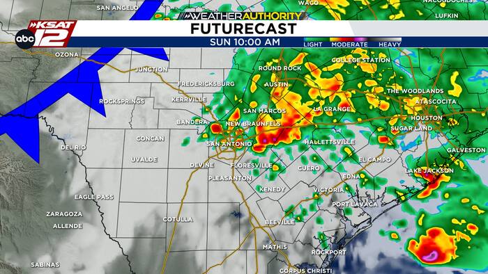
COOL, CLOUDY AND PERIODICALLY RAINY
Sunday will be cool, cloudy and periodically rainy across South-Central Texas, with highs in the low 60s around San Antonio and 50s across the Hill Country. A few stronger storms could develop late this morning into early afternoon, mainly east of I-35 and toward the Coastal Plains.

This will brig wind gusts up to 60 mph and hail up to quarter size. The overall severe weather threat remains limited, but stronger storms cannot be ruled out.Rainfall totals of 0.50 to 1.50 inches are expected for most areas, with isolated amounts of 2 to 3 inches possible near the Coastal Plains. Heavier downpours could lead to localized flooding. Expect wet roads and reduced visibility, and remember to never drive through flooded roadways.

CHILLY MORNINGS
Colder air will settle across South-Central Texas to start the workweek, keeping Monday and Tuesday chilly with afternoon highs mainly in the 50s. Some Hill Country communities could remain in the 40s early Monday, with northerly winds adding to the chill. Rain chances will decrease as the weekend weather system moves away, bringing mostly dry conditions.
EXTENDED OUTLOOK
Temperatures will gradually rebound Wednesday through Friday, climbing closer to seasonal November averages. Conditions should remain relatively quiet through midweek, but rain chances could return by Friday. The timing and coverage of any late-week showers remain uncertain, so stay tuned for forecast updates.


